• 825 Massachusetts Ave (parcel map) (google map)
  • City lot
  • 21200 square feet, 7999 sqft lot. (2.7 FAR)
  • Zone: C-2B
  • Height: ~37.0 feet
  • Built 1905
  • Last Sold 12/17/1979 (500000)
  • 250 Fresh Pond Pkwy (parcel map) (google map)
  • Utility Authority
  • 124527 square feet, 2982289 sqft lot. (0.0 FAR)
  • Zone: OS
  • Height: ~59.6 feet
  • Built 2000
  • 637 Main St (parcel map) (google map)
  • Housing Authority
  • 243144 square feet, 378449 sqft lot. (0.6 FAR)
  • Zone: C-1
  • Height: ~42.0 feet
  • Built 1940
  • 43 Smith Pl (parcel map) (google map)
  • Utility
  • 0 square feet, 7778 sqft lot. (0.0 FAR)
  • Zone: O-1
  • Height: ~8.7 feet
  • Built 1951
  • 18 Cushing Court (parcel map) (google map)
  • Housing Authority
  • 121598 square feet, 302686 sqft lot. (0.4 FAR)
  • Zone: C-1
  • Height: ~29.1 feet
  • Built 1965
  • 195-207 River St (parcel map) (google map)
  • Housing Authority
  • 37923 square feet, 57367 sqft lot. (0.7 FAR)
  • Zone: C-1
  • Height: ~40.0 feet
  • Built 1985
  • Last Sold 8/6/1981 (6049401)
  • 353 Broadway (parcel map) (google map)
  • Improved Local Edu
  • 74607 square feet, 52336 sqft lot. (1.4 FAR)
  • Zone: C-1
  • Height: ~47.7 feet
  • Built 1930
  • 8 Camelia Ave (parcel map) (google map)
  • City lot
  • 2401 square feet, 3092 sqft lot. (0.8 FAR)
  • Zone: C-2
  • Height: ~37.7 feet
  • Built 1920
  • Last Sold 3/13/1992 (275000)
  • 40 Granite St (parcel map) (google map)
  • City lot
  • 84021 square feet, 231126 sqft lot. (0.4 FAR)
  • Zone: C
  • Height: ~36.0 feet
  • Built 1965
  • 259 Charles St (parcel map) (google map)
  • Vacant city property
  • 0 square feet, 111328 sqft lot. (0.0 FAR)
  • Zone: OS
  • Height: ~24.4 feet
  • Built 0
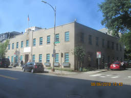
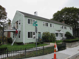
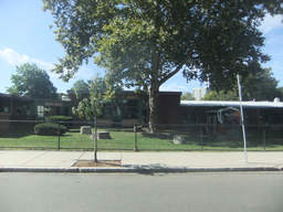
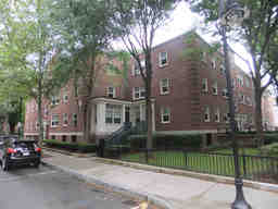
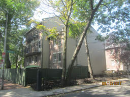
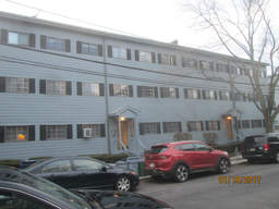
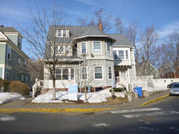
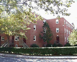
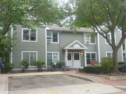
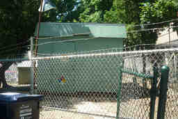
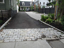
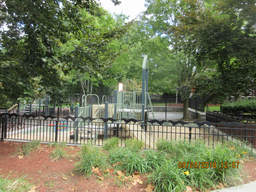
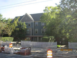
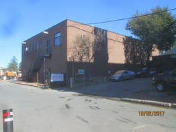
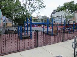
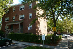
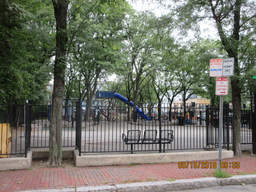
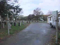
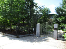
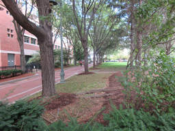
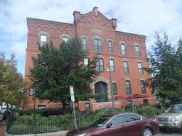
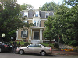
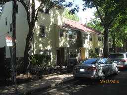
  • 45 Linnaean St (parcel map) (google map)
  • Housing Authority
  • 14967 square feet, 19296 sqft lot. (0.8 FAR)
  • Zone: A-2
  • Height: ~37.4 feet
  • Built 1965
  • Last Sold 12/6/1979 (480000)
  • 105 Windsor St (parcel map) (google map)
  • City lot
  • 13104 square feet, 10063 sqft lot. (1.3 FAR)
  • Zone: C-1
  • Height: ~49.3 feet
  • Built 1900
  • 315 Vassar St (parcel map) (google map)
  • Utility
  • 0 square feet, 9353 sqft lot. (0.0 FAR)
  • Zone: SD-11
  • Height: ~9.8 feet
  • Built 1951
  • 903 Cambridge St (parcel map) (google map)
  • Housing Authority
  • 218242 square feet, 180288 sqft lot. (1.2 FAR)
  • Zone: C-2
  • Height: ~119.0 feet
  • Built 1930
  • 70 Rindge Ave (parcel map) (google map)
  • Improved Local Edu
  • 145715 square feet, 156182 sqft lot. (0.9 FAR)
  • Zone: B
  • Height: ~28.3 feet
  • Built 1900
  • 108 Harvard St (parcel map) (google map)
  • Housing Authority
  • 276055 square feet, 362210 sqft lot. (0.8 FAR)
  • Zone: C-1
  • Height: ~29.5 feet
  • Built 1940
  • 85 Oxford St (parcel map) (google map)
  • Improved Local Edu
  • 45480 square feet, 25489 sqft lot. (1.8 FAR)
  • Zone: B
  • Height: ~60.1 feet
  • Built 1995
  • 183-185 Cambridge St (parcel map) (google map)
  • Improved Public Safety
  • 14780 square feet, 26115 sqft lot. (0.6 FAR)
  • Zone: BA
  • Height: ~42.7 feet
  • Built 1980
  • 223 Garden St (parcel map) (google map)
  • City lot
  • 4023 square feet, 2514445 sqft lot. (0.0 FAR)
  • Zone: OS
  • Height: ~42.1 feet
  • Built 2000
  • 91 Magazine St (parcel map) (google map)
  • Housing Authority
  • 10112 square feet, 13200 sqft lot. (0.8 FAR)
  • Zone: C
  • Height: ~40.8 feet
  • Built 1930
  • 11 Norfolk Ct (parcel map) (google map)
  • Utility Authority
  • 64 square feet, 1230 sqft lot. (0.1 FAR)
  • Zone: BA
  • Height: ~34.8 feet
  • Built 1980
  • 266 Rindge Ave (parcel map) (google map)
  • Condo building
  • 4953 square feet, 8655 sqft lot. (0.6 FAR)
  • Zone: B
  • Height: ~22.3 feet
  • Built 2001
  • Last Sold 12/31/1899 (42601)
  • 23 Springfield St (parcel map) (google map)
  • Vacant city property
  • 0 square feet, 3050 sqft lot. (0.0 FAR)
  • Zone: BA
  • Height: ~7.0 feet
  • Built 0
  • 26 Sacramento St (parcel map) (google map)
  • Vacant Local Education
  • 0 square feet, 3778 sqft lot. (0.0 FAR)
  • Zone: B
  • Height: ~60.1 feet
  • Built 0
  • Last Sold 12/7/1993 (95000)
  • 81-87 Amory St (parcel map) (google map)
  • Condo building
  • 8740 square feet, 9139 sqft lot. (1.0 FAR)
  • Zone: C-1
  • Height: ~45.2 feet
  • Built 1974
  • Last Sold 1/22/1988 (1689930)
  • Cushing Ct (parcel map) (google map)
  • Housing Authority
  • 25548 square feet, 66663 sqft lot. (0.4 FAR)
  • Zone: C-1
  • Height: ~27.5 feet
  • Built 1902
  • 21 Sacramento St (parcel map) (google map)
  • Vacant city property
  • 0 square feet, 10664 sqft lot. (0.0 FAR)
  • Zone: OS
  • Height: ~7.4 feet
  • Built 0
  • Last Sold 3/31/1980 (480000)
  • 59-67 Cambridge Pkwy (parcel map) (google map)
  • Vacant city property
  • 0 square feet, 41537 sqft lot. (0.0 FAR)
  • Zone: PUD-2
  • Height: ~141.8 feet
  • Built 0
  • 116 Cushing St (parcel map) (google map)
  • Improved Local Edu
  • 50409 square feet, 46707 sqft lot. (1.1 FAR)
  • Zone: B
  • Height: ~55.2 feet
  • Built 2000
  • 10 Camelia Ave (parcel map) (google map)
  • City lot
  • 5700 square feet, 3933 sqft lot. (1.4 FAR)
  • Zone: C-2
  • Height: ~40.4 feet
  • Built 1920
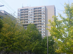
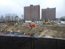
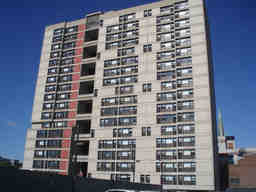
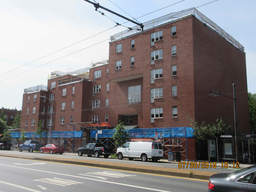
  • 3 Lambert St (parcel map) (google map)
  • Housing Authority
  • 173634 square feet, 74157 sqft lot. (2.3 FAR)
  • Zone: C-3
  • Height: ~181.7 feet
  • Built 1970
  • Last Sold 5/31/2016 (37430000)
  • 114 Pemberton St (parcel map) (google map)
  • Vacant city property
  • 0 square feet, 148690 sqft lot. (0.0 FAR)
  • Zone: OS
  • Height: ~28.3 feet
  • Built 0
  • 328 Allston St (parcel map) (google map)
  • Vacant city property
  • 0 square feet, 15352 sqft lot. (0.0 FAR)
  • Zone: OS
  • Height: ~16.1 feet
  • Built 0
  • 171 Harvard St (parcel map) (google map)
  • Improved Local Edu
  • 98416 square feet, 35639 sqft lot. (2.8 FAR)
  • Zone: C-1
  • Height: ~57.6 feet
  • Built 1929
  • 2-19 Jackson Pl (parcel map) (google map)
  • Housing Authority
  • 18432 square feet, 38192 sqft lot. (0.5 FAR)
  • Zone:
  • Height: ~33.7 feet
  • Built 1940
  • 90 Pacific St (parcel map) (google map)
  • Vacant city property
  • 0 square feet, 59887 sqft lot. (0.0 FAR)
  • Zone: OS
  • Height: ~46.4 feet
  • Built 0
  • 258 Hurley St (parcel map) (google map)
  • Vacant city property
  • 0 square feet, 14063 sqft lot. (0.0 FAR)
  • Zone: OS
  • Height: ~38.9 feet
  • Built 0
  • 72-82 Clifton St (parcel map) (google map)
  • City lot
  • 12740 square feet, 468514 sqft lot. (0.0 FAR)
  • Zone: OS
  • Height: ~35.4 feet
  • Built 1960
  • 98 Putnam Ave (parcel map) (google map)
  • Vacant Local Education
  • 116664 square feet, 139565 sqft lot. (0.8 FAR)
  • Zone: C-1
  • Height: ~9.1 feet
  • Built 1965
  • 250 Fresh Pond Pkwy (parcel map) (google map)
  • Vacant Utility Authority
  • 0 square feet, 6883128 sqft lot. (0.0 FAR)
  • Zone: OS
  • Height: ~19.9 feet
  • Built 0
  • 12 Hingham St (parcel map) (google map)
  • Housing Authority
  • 4476 square feet, 5927 sqft lot. (0.8 FAR)
  • Zone: C-1
  • Height: ~24.2 feet
  • Built 1985
  • Coolidge Ave (parcel map) (google map)
  • City lot
  • 1697 square feet, 2599670 sqft lot. (0.0 FAR)
  • Zone: OS
  • Height: ~66.3 feet
  • Built 1840
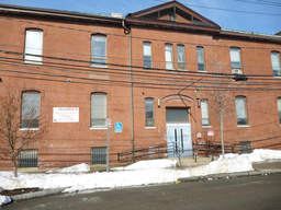
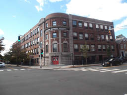
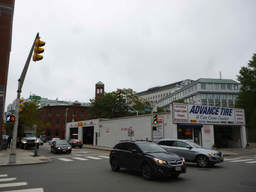
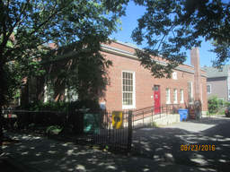
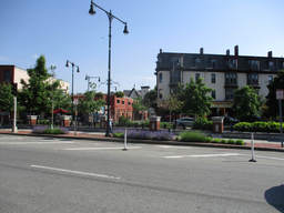
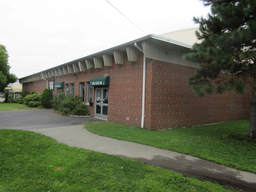
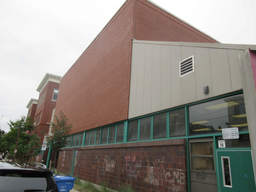
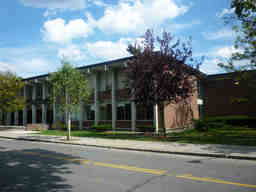
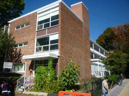
  • 454 Broadway (parcel map) (google map)
  • Improved Local Edu
  • 18627 square feet, 19719 sqft lot. (0.9 FAR)
  • Zone: C-1
  • Height: ~13.7 feet
  • Built 1930
  • Last Sold 6/21/1974 (300000)
  • 1500 Massachusetts Ave (parcel map) (google map)
  • Vacant city property
  • 0 square feet, 357735 sqft lot. (0.0 FAR)
  • Zone: OS
  • Height: ~9.6 feet
  • Built 0
  • 7 Edmunds St (parcel map) (google map)
  • Utility
  • 240 square feet, 3384 sqft lot. (0.1 FAR)
  • Zone: BA-2
  • Height: ~11.0 feet
  • Built 1960
  • 189 Broadway (parcel map) (google map)
  • Auto Repair
  • 4646 square feet, 4946 sqft lot. (0.9 FAR)
  • Zone: IB
  • Height: ~22.7 feet
  • Built 1916
  • 9 Fairmont St (parcel map) (google map)
  • Housing Authority
  • 61404 square feet, 37331 sqft lot. (1.6 FAR)
  • Zone: C
  • Height: ~43.4 feet
  • Built 1920
  • 1 Western Ave (parcel map) (google map)
  • City lot
  • 48692 square feet, 12835 sqft lot. (3.8 FAR)
  • Zone: BA
  • Height: ~64.0 feet
  • Built 1933
  • 2039 Massachusetts Ave (parcel map) (google map)
  • Improved Public Safety
  • 8625 square feet, 9115 sqft lot. (0.9 FAR)
  • Zone: BA-2
  • Height: ~61.9 feet
  • Built 1896
  • 116 Norfolk St (parcel map) (google map)
  • Housing Authority
  • 19346 square feet, 24712 sqft lot. (0.8 FAR)
  • Zone: C-1
  • Height: ~54.2 feet
  • Built 1920
  • 453 Massachusetts Ave (parcel map) (google map)
  • Vacant city property
  • 0 square feet, 26201 sqft lot. (0.0 FAR)
  • Zone: BB-CSQ
  • Height: ~34.1 feet
  • Built 0
  • 1 Jackson Pl (parcel map) (google map)
  • Housing Authority
  • 22622 square feet, 70091 sqft lot. (0.3 FAR)
  • Zone:
  • Height: ~35.0 feet
  • Built 1940
  • 50 Willow St (parcel map) (google map)
  • Housing Authority
  • 20302 square feet, 25456 sqft lot. (0.8 FAR)
  • Zone: C-1
  • Height: ~29.1 feet
  • Built 1960
  • Last Sold 10/12/1976 (1260000)
  • 52 Walden St (parcel map) (google map)
  • Utility
  • 360 square feet, 2454 sqft lot. (0.1 FAR)
  • Zone: B
  • Height: ~17.7 feet
  • Built 1927
  • 21 Valentine St (parcel map) (google map)
  • Housing Authority
  • 5112 square feet, 7529 sqft lot. (0.7 FAR)
  • Zone: C
  • Height: ~41.1 feet
  • Built 1905
  • Last Sold 1/1/1974 (181078)
  • 145 Prospect St (parcel map) (google map)
  • Vacant city property
  • 0 square feet, 1373 sqft lot. (0.0 FAR)
  • Zone: C-1
  • Height: ~39.1 feet
  • Built 0
  • 640 Concord Ave (parcel map) (google map)
  • City lot
  • 41072 square feet, 82193 sqft lot. (0.5 FAR)
  • Zone: OS
  • Height: ~36.2 feet
  • Built 2002
  • 45 Jackson Cir (parcel map) (google map)
  • Housing Authority
  • 17640 square feet, 32415 sqft lot. (0.5 FAR)
  • Zone:
  • Height: ~32.4 feet
  • Built 1940
  • 48 Sixth St (parcel map) (google map)
  • City lot
  • 3000 square feet, 9765 sqft lot. (0.3 FAR)
  • Zone: C-1
  • Height: ~21.3 feet
  • Built 1900
  • 815 Massachusetts Ave (parcel map) (google map)
  • City lot
  • 52800 square feet, 45077 sqft lot. (1.2 FAR)
  • Zone: O-3
  • Height: ~152.3 feet
  • Built 1889
  • 283 Norfolk St (parcel map) (google map)
  • City lot
  • 53054 square feet, 72245 sqft lot. (0.7 FAR)
  • Zone: C-1
  • Height: ~30.8 feet
  • Built 1886
  • 115-117 Jackson St (parcel map) (google map)
  • Housing Authority
  • 8756 square feet, 11914 sqft lot. (0.7 FAR)
  • Zone: B
  • Height: ~40.2 feet
  • Built 1930
  • Last Sold 10/25/1974 (572904)
  • 179-181 Broadway (parcel map) (google map)
  • Utility
  • 1195 square feet, 13442 sqft lot. (0.1 FAR)
  • Zone: IB
  • Height: ~25.3 feet
  • Built 1873
  • 201 Western Ave (parcel map) (google map)
  • City lot
  • 4280 square feet, 5312 sqft lot. (0.8 FAR)
  • Zone: BA-3
  • Height: ~32.6 feet
  • Built 1997
  • Last Sold 8/30/1991 (140000)
  • 119 Larch Rd (parcel map) (google map)
  • Vacant city property
  • 0 square feet, 17376 sqft lot. (0.0 FAR)
  • Zone: OS
  • Height: ~8.2 feet
  • Built 0
  • 12 Charles St (parcel map) (google map)
  • Utility
  • 0 square feet, 3475 sqft lot. (0.0 FAR)
  • Zone: PUD-4B-BA
  • Height: ~9.6 feet
  • Built 1920
  • 17 Eighth St (parcel map) (google map)
  • Housing Authority
  • 45392 square feet, 21769 sqft lot. (2.1 FAR)
  • Zone: C-1
  • Height: ~89.5 feet
  • Built 1969
  • 197 Vassal Ln (parcel map) (google map)
  • Improved Local Edu
  • 125048 square feet, 395234 sqft lot. (0.3 FAR)
  • Zone: OS
  • Height: ~55.1 feet
  • Built 1975
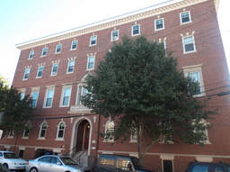
  • 51 Inman St (parcel map) (google map)
  • City lot
  • 28376 square feet, 8610 sqft lot. (3.3 FAR)
  • Zone: C-1
  • Height: ~68.7 feet
  • Built 1917
  • Last Sold 6/4/1975 (75000)
  • 380 Massachusetts Ave (parcel map) (google map)
  • Improved Public Safety
  • 10553 square feet, 10325 sqft lot. (1.0 FAR)
  • Zone: BB-CSQ
  • Height: ~79.2 feet
  • Built 1890
  • 1 Roberts Rd (parcel map) (google map)
  • Utility
  • 880 square feet, 7336 sqft lot. (0.1 FAR)
  • Zone: C-1
  • Height: ~17.7 feet
  • Built 1970
  • 214 Hampshire St (parcel map) (google map)
  • Improved Public Safety
  • 11568 square feet, 6367 sqft lot. (1.8 FAR)
  • Zone: BA
  • Height: ~64.5 feet
  • Built 1912
  • 1713-5 Massachusetts Ave (parcel map) (google map)
  • Housing Authority
  • 7485 square feet, 15110 sqft lot. (0.5 FAR)
  • Zone: BA-2
  • Height: ~37.6 feet
  • Built 1992
  • Last Sold 9/26/1997 (1184300)
  • 385 Massachusetts Ave (parcel map) (google map)
  • Vacant city property
  • 0 square feet, 15838 sqft lot. (0.0 FAR)
  • Zone:
  • Height: ~42.6 feet
  • Built 0
  • 29 Third St (parcel map) (google map)
  • City lot
  • 6296 square feet, 5347 sqft lot. (1.2 FAR)
  • Zone: C-1
  • Height: ~51.9 feet
  • Built 1890
  • 491 Broadway (parcel map) (google map)
  • Improved Public Safety
  • 24670 square feet, 21312 sqft lot. (1.2 FAR)
  • Zone: C-3
  • Height: ~80.8 feet
  • Built 1932
  • 1-6 Jefferson Pk (parcel map) (google map)
  • Housing Authority
  • 0 square feet, 137225 sqft lot. (0.0 FAR)
  • Zone: B
  • Height: ~25.0 feet
  • Built 0
  • 80 Haskell St (parcel map) (google map)
  • Vacant city property
  • 0 square feet, 48060 sqft lot. (0.0 FAR)
  • Zone: OS
  • Height: ~34.2 feet
  • Built 0
  • 123 Gore St (parcel map) (google map)
  • Vacant city property
  • 0 square feet, 156644 sqft lot. (0.0 FAR)
  • Zone: OS
  • Height: ~34.2 feet
  • Built 0
  • 377-379 Putnam Ave (parcel map) (google map)
  • Utility
  • 22875 square feet, 89796 sqft lot. (0.3 FAR)
  • Zone: C-2B
  • Height: ~40.2 feet
  • Built 1985
  • 32 Flagg St (parcel map) (google map)
  • Vacant city property
  • 0 square feet, 62245 sqft lot. (0.0 FAR)
  • Zone: OS
  • Height: ~33.9 feet
  • Built 0
  • 209 Otis St (parcel map) (google map)
  • Utility
  • 0 square feet, 12840 sqft lot. (0.0 FAR)
  • Zone: C-1
  • Height: ~51.9 feet
  • Built 1980
  • 113 Elm St (parcel map) (google map)
  • Vacant city property
  • 0 square feet, 9961 sqft lot. (0.0 FAR)
  • Zone: C-1
  • Height: ~54.6 feet
  • Built 0
  • 688 Huron Ave (parcel map) (google map)
  • City lot
  • 8142 square feet, 29444 sqft lot. (0.3 FAR)
  • Zone: C-3
  • Height: ~44.9 feet
  • Built 2007
  • 798 Massachusetts Ave (parcel map) (google map)
  • City lot
  • 27552 square feet, 12924 sqft lot. (2.1 FAR)
  • Zone: O-3
  • Height: ~77.5 feet
  • Built 1925
  • Last Sold 12/5/1991 (1650000)
  • 100 Brattle St (parcel map) (google map)
  • Vacant city property
  • 0 square feet, 89178 sqft lot. (0.0 FAR)
  • Zone: OS
  • Height: ~8.4 feet
  • Built 0
  • 73 Clifton St (parcel map) (google map)
  • Housing Authority
  • 14996 square feet, 11525 sqft lot. (1.3 FAR)
  • Zone: B
  • Height: ~34.3 feet
  • Built 1930
  • 1 Carleton St (parcel map) (google map)
  • Vacant city property
  • 0 square feet, 30741 sqft lot. (0.0 FAR)
  • Zone: IB
  • Height: ~9.7 feet
  • Built 0
  • 109 Garden St (parcel map) (google map)
  • Improved Public Safety
  • 11118 square feet, 10622 sqft lot. (1.0 FAR)
  • Zone: C-1
  • Height: ~52.9 feet
  • Built 1920
  • 650 Concord Ave (parcel map) (google map)
  • ASSISTED-LIV
  • 134025 square feet, 266325 sqft lot. (0.5 FAR)
  • Zone: OS
  • Height: ~39.2 feet
  • Built 2002
  • 121 Cushing St (parcel map) (google map)
  • Vacant Local Education
  • 0 square feet, 7039 sqft lot. (0.0 FAR)
  • Zone: B
  • Height: ~14.3 feet
  • Built 0
  • 56R Aberdeen Ave (parcel map) (google map)
  • Utility
  • 0 square feet, 2476 sqft lot. (0.0 FAR)
  • Zone: BA-1
  • Height: ~15.6 feet
  • Built 1922
  • 300 Norfolk St (parcel map) (google map)
  • City lot
  • 12000 square feet, 34480 sqft lot. (0.3 FAR)
  • Zone: C-1
  • Height: ~27.4 feet
  • Built 0
  • 71 Charles St (parcel map) (google map)
  • Vacant city property
  • 0 square feet, 25125 sqft lot. (0.0 FAR)
  • Zone: OS
  • Height: ~35.5 feet
  • Built 0
  • 503 Concord Ave (parcel map) (google map)
  • Utility
  • 400 square feet, 27029 sqft lot. (0.0 FAR)
  • Zone: IA-1
  • Height: ~20.1 feet
  • Built 1867
  • 108 Sherman St (parcel map) (google map)
  • Multi-use residential
  • 1814 square feet, 10129 sqft lot. (0.2 FAR)
  • Zone: B
  • Height: ~25.9 feet
  • Built 1902
  • 99 Elm St (parcel map) (google map)
  • Vacant city property
  • 0 square feet, 2479 sqft lot. (0.0 FAR)
  • Zone: C-1
  • Height: ~54.6 feet
  • Built 0
  • 145 Gore St (parcel map) (google map)
  • Vacant city property
  • 0 square feet, 9370 sqft lot. (0.0 FAR)
  • Zone: OS
  • Height: ~34.2 feet
  • Built 0
  • 139 Bishop Allen Dr (parcel map) (google map)
  • City lot
  • 17850 square feet, 29229 sqft lot. (0.6 FAR)
  • Zone: C-1
  • Height: ~33.3 feet
  • Built 1914
  • 1481 Cambridge St (parcel map) (google map)
  • City lot
  • 292856 square feet, 176991 sqft lot. (1.7 FAR)
  • Zone: C-2
  • Height: ~113.2 feet
  • Built 1945
  • Reed Street Ct (parcel map) (google map)
  • Vacant city property
  • 0 square feet, 1410 sqft lot. (0.0 FAR)
  • Zone:
  • Height: ~37.8 feet
  • Built 0
  • 21-132 Jackson Pl (parcel map) (google map)
  • Housing Authority
  • 115347 square feet, 141894 sqft lot. (0.8 FAR)
  • Zone:
  • Height: ~67.3 feet
  • Built 1940
  • 158 Spring St (parcel map) (google map)
  • Improved Local Edu
  • 119880 square feet, 93172 sqft lot. (1.3 FAR)
  • Zone: C-1
  • Height: ~45.9 feet
  • Built 1965
  • 243 Harvard St (parcel map) (google map)
  • City lot
  • 18314 square feet, 10073 sqft lot. (1.8 FAR)
  • Zone: C-1
  • Height: ~48.6 feet
  • Built 1980
  • 98 Aberdeen Ave (parcel map) (google map)
  • Housing Authority
  • 2860 square feet, 5005 sqft lot. (0.6 FAR)
  • Zone: B
  • Height: ~32.0 feet
  • Built 1910
  • Last Sold 6/30/1986 (290000)
  • Montague St (parcel map) (google map)
  • City lot
  • 10173 square feet, 206921 sqft lot. (0.0 FAR)
  • Zone: OS
  • Height: ~33.7 feet
  • Built 1975
  • Norfolk St (parcel map) (google map)
  • Vacant city property
  • 0 square feet, 11000 sqft lot. (0.0 FAR)
  • Zone: C-1
  • Height: ~22.4 feet
  • Built 0
  • 32 Jefferson St (parcel map) (google map)
  • Vacant Local Education
  • 0 square feet, 15153 sqft lot. (0.0 FAR)
  • Zone: C-1
  • Height: ~35.2 feet
  • Built 0
  • 691 Huron Ave (parcel map) (google map)
  • City lot
  • 4260 square feet, 3692857 sqft lot. (0.0 FAR)
  • Zone: OS
  • Height: ~38.2 feet
  • Built 1932
  • 50 Coolidge Ave (parcel map) (google map)
  • Vacant city property
  • 0 square feet, 141678 sqft lot. (0.0 FAR)
  • Zone: OS
  • Height: ~33.3 feet
  • Built 0
  • 251 Brookline St (parcel map) (google map)
  • Vacant Local Education
  • 0 square feet, 26261 sqft lot. (0.0 FAR)
  • Zone: OS
  • Height: ~31.0 feet
  • Built 0
  • 62 Aberdeen Ave (parcel map) (google map)
  • City lot
  • 3822 square feet, 4929 sqft lot. (0.8 FAR)
  • Zone: B
  • Height: ~24.4 feet
  • Built 1920
  • 125-127 Whittemore Ave (parcel map) (google map)
  • Housing Authority
  • 2204 square feet, 5746 sqft lot. (0.4 FAR)
  • Zone: B
  • Height: ~30.4 feet
  • Built 1915
  • Last Sold 8/11/1997 (201652)
  • 4 King St (parcel map) (google map)
  • Utility
  • 630 square feet, 3715 sqft lot. (0.2 FAR)
  • Zone: B
  • Height: ~19.5 feet
  • Built 1875
  • 23 Healey St (parcel map) (google map)
  • Utility
  • 954 square feet, 5221 sqft lot. (0.2 FAR)
  • Zone: A-2
  • Height: ~23.3 feet
  • Built 1925
  • 46 Lee St (parcel map) (google map)
  • Vacant city property
  • 0 square feet, 10211 sqft lot. (0.0 FAR)
  • Zone: OS
  • Height: ~34.4 feet
  • Built 0
  • 170 River St (parcel map) (google map)
  • Improved Public Safety
  • 4436 square feet, 5004 sqft lot. (0.9 FAR)
  • Zone: BA-3
  • Height: ~44.1 feet
  • Built 1890
  • 445 Broadway (parcel map) (google map)
  • Improved Local Edu
  • 125574 square feet, 134286 sqft lot. (0.9 FAR)
  • Zone: C-3
  • Height: ~81.8 feet
  • Built 1920
  • 87 Elm St (parcel map) (google map)
  • Improved Local Edu
  • 58502 square feet, 23809 sqft lot. (2.5 FAR)
  • Zone: C-1
  • Height: ~54.6 feet
  • Built 1920
  • 859 Massachusetts Ave (parcel map) (google map)
  • City lot
  • 5136 square feet, 4804 sqft lot. (1.1 FAR)
  • Zone: C-2B
  • Height: ~41.1 feet
  • Built 1887
  • 1407 Cambridge St (parcel map) (google map)
  • Vacant city property
  • 0 square feet, 6039 sqft lot. (0.0 FAR)
  • Zone: OS
  • Height: ~36.0 feet
  • Built 0
  • Last Sold 1/21/1980 (84000)
  • 61-76 Jackson Cir (parcel map) (google map)
  • Housing Authority
  • 17640 square feet, 30035 sqft lot. (0.6 FAR)
  • Zone:
  • Height: ~32.9 feet
  • Built 1940
  • 8 Mellen St (parcel map) (google map)
  • Utility
  • 840 square feet, 2858 sqft lot. (0.3 FAR)
  • Zone: C-1
  • Height: ~19.0 feet
  • Built 1875
  • 117 Rogers St (parcel map) (google map)
  • City lot
  • 53027 square feet, 35246 sqft lot. (1.5 FAR)
  • Zone: PUD-4B-IA1
  • Height: ~43.2 feet
  • Built 1900
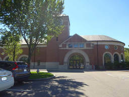
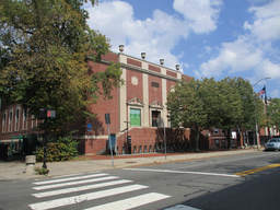
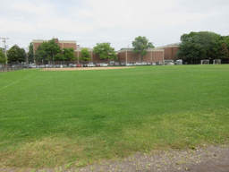
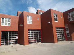
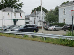
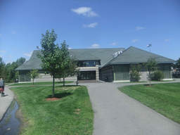
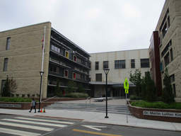
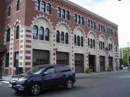
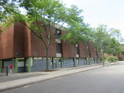
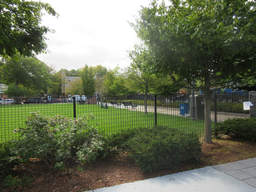
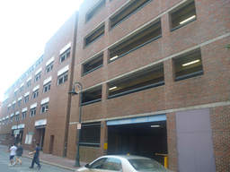
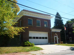
  • 125 Sixth St (parcel map) (google map)
  • Improved Public Safety
  • 97392 square feet, 26241 sqft lot. (3.7 FAR)
  • Zone: IA-1
  • Height: ~84.6 feet
  • Built 2002
  • Last Sold 5/18/2005 (29550000)
  • 9 Upton St (parcel map) (google map)
  • Improved Local Edu
  • 56594 square feet, 35175 sqft lot. (1.6 FAR)
  • Zone: C
  • Height: ~60.7 feet
  • Built 1915
  • 33 Sacramento St (parcel map) (google map)
  • Vacant Local Education
  • 0 square feet, 11815 sqft lot. (0.0 FAR)
  • Zone: OS
  • Height: ~36.5 feet
  • Built 0
  • 101 Elm St (parcel map) (google map)
  • Vacant city property
  • 0 square feet, 3017 sqft lot. (0.0 FAR)
  • Zone: C-1
  • Height: ~54.6 feet
  • Built 0
  • 240 Green St (parcel map) (google map)
  • City lot
  • 153194 square feet, 55792 sqft lot. (2.7 FAR)
  • Zone: C-3
  • Height: ~203.2 feet
  • Built 1969
  • Holworthy Pl (parcel map) (google map)
  • Vacant city property
  • 0 square feet, 7711 sqft lot. (0.0 FAR)
  • Zone: B
  • Height: ~35.7 feet
  • Built 0
  • 121 Fairview Ave (parcel map) (google map)
  • Vacant city property
  • 0 square feet, 193061 sqft lot. (0.0 FAR)
  • Zone: C-1
  • Height: ~29.4 feet
  • Built 0
  • 2060 Massachusetts Ave (parcel map) (google map)
  • Housing Authority
  • 43864 square feet, 15325 sqft lot. (2.9 FAR)
  • Zone: BA-2
  • Height: ~58.6 feet
  • Built 1980
  • 11 Woodbridge St (parcel map) (google map)
  • Housing Authority
  • 6853 square feet, 6366 sqft lot. (1.1 FAR)
  • Zone: B
  • Height: ~44.5 feet
  • Built 1900
  • Last Sold 1/11/2000 (630000)
  • Lowell St (parcel map) (google map)
  • City lot
  • 5898 square feet, 12224 sqft lot. (0.5 FAR)
  • Zone: B
  • Height: ~44.5 feet
  • Built 1875
  • 1700 Cambridge St (parcel map) (google map)
  • Improved Local Edu
  • 232793 square feet, 139619 sqft lot. (1.7 FAR)
  • Zone: C-3
  • Height: ~79.0 feet
  • Built 1920
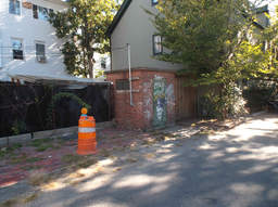
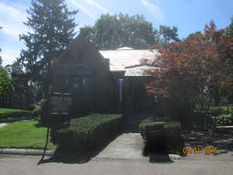
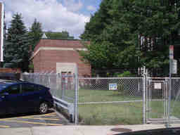
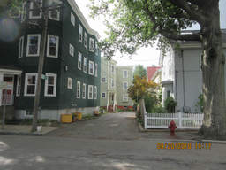
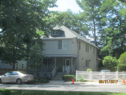
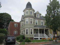
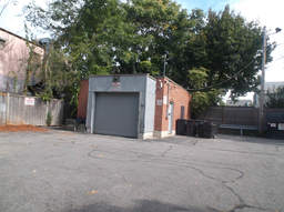
  • 3 Bigelow St (parcel map) (google map)
  • City lot
  • 4790 square feet, 5274 sqft lot. (0.9 FAR)
  • Zone: C-2B
  • Height: ~45.1 feet
  • Built 1869
  • Last Sold 4/10/1987 (200000)
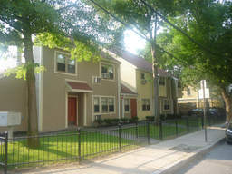
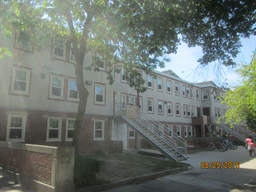
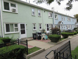
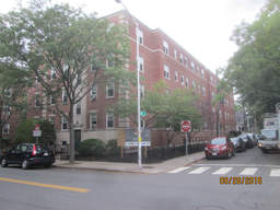
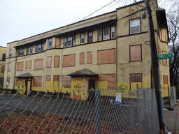
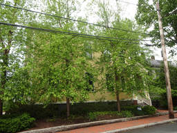
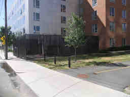
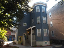
  • 15 Inman St (parcel map) (google map)
  • Housing Authority
  • 4800 square feet, 6838 sqft lot. (0.7 FAR)
  • Zone: C-1
  • Height: ~41.2 feet
  • Built 1910
  • Last Sold 3/16/1978 (91000)
  • 41 Land Blvd (parcel map) (google map)
  • Shopping Center
  • 0 square feet, 9765 sqft lot. (0.0 FAR)
  • Zone: PUD-4
  • Height: ~105.2 feet
  • Built 1923
  • 15 Magee St (parcel map) (google map)
  • Vacant Local Education
  • 0 square feet, 3709 sqft lot. (0.0 FAR)
  • Zone: C-1
  • Built 0
  • 123-125 Berkshire St (parcel map) (google map)
  • Improved Local Edu
  • 2460 square feet, 507878 sqft lot. (0.0 FAR)
  • Zone: OS
  • Height: ~35.1 feet
  • Built 1959
  • 259 Prospect St (parcel map) (google map)
  • Utility
  • 6860 square feet, 32493 sqft lot. (0.2 FAR)
  • Zone: C-1
  • Height: ~35.8 feet
  • Built 1964
  • 27 Western Ave (parcel map) (google map)
  • City lot
  • 0 square feet, 2572 sqft lot. (0.0 FAR)
  • Zone: BA
  • Height: ~28.9 feet
  • Built 0
  • Last Sold 11/22/1976 (19100)
  • 10 Peters St (parcel map) (google map)
  • Vacant city property
  • 0 square feet, 17722 sqft lot. (0.0 FAR)
  • Zone: OS
  • Height: ~36.0 feet
  • Built 0
  • 441 Broadway (parcel map) (google map)
  • Improved Local Edu
  • 155820 square feet, 230648 sqft lot. (0.7 FAR)
  • Zone: OS
  • Height: ~81.8 feet
  • Built 1920
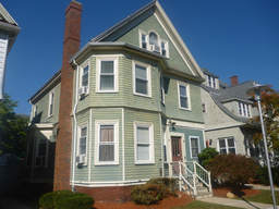
  • 226 Norfolk St (parcel map) (google map)
  • Housing Authority
  • 2607 square feet, 3862 sqft lot. (0.7 FAR)
  • Zone: C-1
  • Height: ~37.3 feet
  • Built 1929
  • Last Sold 12/17/1992 (249006)
  • 15 Norfolk Ct (parcel map) (google map)
  • Vacant Utility Authority
  • 0 square feet, 1172 sqft lot. (0.0 FAR)
  • Zone: BA
  • Height: ~9.0 feet
  • Built 0
  • 35-55 Clarendon Ave (parcel map) (google map)
  • Housing Authority
  • 118585 square feet, 63741 sqft lot. (1.9 FAR)
  • Zone: C-3
  • Height: ~77.5 feet
  • Built 1970
  • 86 Otis St (parcel map) (google map)
  • Housing Authority
  • 31764 square feet, 14681 sqft lot. (2.2 FAR)
  • Zone: C-1
  • Height: ~69.8 feet
  • Built 1890
  • 40 Dickinson St (parcel map) (google map)
  • Vacant city property
  • 0 square feet, 66444 sqft lot. (0.0 FAR)
  • Zone: OS
  • Height: ~29.1 feet
  • Built 0
  • 57 Commercial Ave (parcel map) (google map)
  • Vacant city property
  • 0 square feet, 12107 sqft lot. (0.0 FAR)
  • Zone: PUD-4
  • Height: ~100.0 feet
  • Built 0
  • 278 Rindge Ave (parcel map) (google map)
  • Housing Authority
  • 4240 square feet, 4565 sqft lot. (0.9 FAR)
  • Zone: B
  • Height: ~21.0 feet
  • Built 1990
  • Last Sold 5/31/1984 (94000)
  • 119 Windsor St (parcel map) (google map)
  • City lot
  • 63023 square feet, 39999 sqft lot. (1.6 FAR)
  • Zone: C-1
  • Height: ~31.5 feet
  • Built 1920
  • Last Sold 4/12/1996 (2690000)
  • 1 Waverly St (parcel map) (google map)
  • Utility
  • 0 square feet, 1057 sqft lot. (0.0 FAR)
  • Zone: SD-8
  • Built 0
  • 51-69 First St (parcel map) (google map)
  • City lot
  • 0 square feet, 75740 sqft lot. (0.0 FAR)
  • Zone: PUD-4B-BA
  • Height: ~72.1 feet
  • Built 1987
  • 155 Willow St (parcel map) (google map)
  • Housing Authority
  • 0 square feet, 12106 sqft lot. (0.0 FAR)
  • Zone: C-1
  • Height: ~11.6 feet
  • Built 1980
  • 1010 Cambridge St (parcel map) (google map)
  • Vacant city property
  • 0 square feet, 12636 sqft lot. (0.0 FAR)
  • Zone: BA
  • Height: ~45.0 feet
  • Built 0
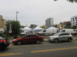
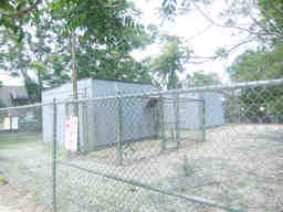
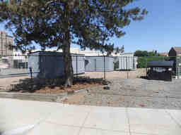
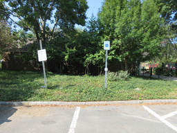
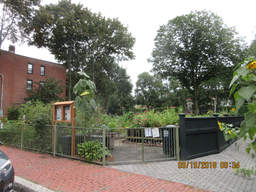
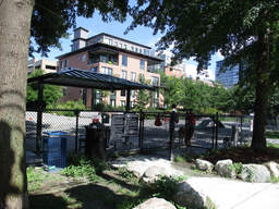
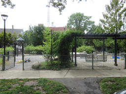
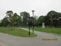
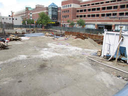
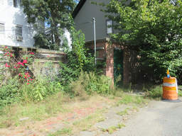
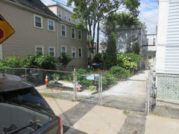
  • 84 Norfolk St (parcel map) (google map)
  • Vacant city property
  • 0 square feet, 34442 sqft lot. (0.0 FAR)
  • Zone: BB-CSQ
  • Height: ~65.3 feet
  • Built 0
  • Last Sold 2/7/1963 (125000)
  • 167 Lexington Ave (parcel map) (google map)
  • Improved Public Safety
  • 4900 square feet, 13454 sqft lot. (0.4 FAR)
  • Zone: B
  • Height: ~26.6 feet
  • Built 1893
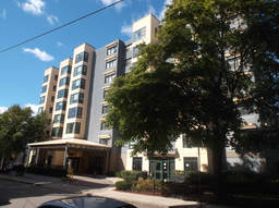
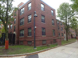
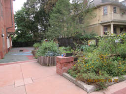
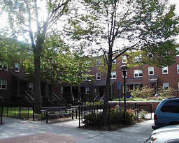
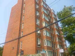
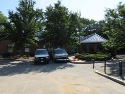
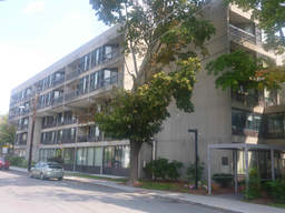
  • 55 Essex St (parcel map) (google map)
  • Housing Authority
  • 61434 square feet, 33031 sqft lot. (1.9 FAR)
  • Zone: C-1
  • Height: ~72.7 feet
  • Built 1980
  • Last Sold 4/2/2002 (4635000)
  • 44-137 Linnaean St (parcel map) (google map)
  • Improved Local Edu
  • 70784 square feet, 99959 sqft lot. (0.7 FAR)
  • Zone: B
  • Height: ~29.4 feet
  • Built 1930
  • 32 First St (parcel map) (google map)
  • Vacant city property
  • 0 square feet, 242839 sqft lot. (0.0 FAR)
  • Zone: OS
  • Height: ~86.2 feet
  • Built 0
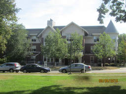
  • 261 River St (parcel map) (google map)
  • Housing Authority
  • 7174 square feet, 6956 sqft lot. (1.0 FAR)
  • Zone: BA-3
  • Height: ~36.1 feet
  • Built 1985
  • Last Sold 8/6/1981 (2016467)
  • 40 Cedar St (parcel map) (google map)
  • Vacant city property
  • 0 square feet, 9667 sqft lot. (0.0 FAR)
  • Zone: OS
  • Height: ~34.4 feet
  • Built 0
  • 55 Inman St (parcel map) (google map)
  • City lot
  • 34135 square feet, 20391 sqft lot. (1.7 FAR)
  • Zone: O-1
  • Height: ~66.4 feet
  • Built 1900
  • 97 Gore St (parcel map) (google map)
  • Vacant city property
  • 0 square feet, 1082 sqft lot. (0.0 FAR)
  • Zone: C-1
  • Height: ~9.9 feet
  • Built 0